Last Updated on July 7, 2022 by Alice Benny
Olympic National Park Hikes ~ There is a lot to see and explore at Olympic National Park, including waterfalls, wildlife, beaches, lakes, rivers, forests, mountains, and lakes. The park has over 186 hiking trails for all levels. Since you can’t hike all of them even with several visits over the years, this article will give you an overview of the 5 best hikes to prioritize at Olympic National Park.
Olympic National Park Hikes
The Hoh Rainforest is a great place to start. The trail is 8 miles round trip and the elevation gain is 1,000 feet. It’s a very popular hike with stunning views of the Olympic Mountains. Another great hike is the Sol Duc Falls Trail. It’s 4 miles one way with an elevation gain of 1,300 feet. You can also camp at the trailhead for a great experience.
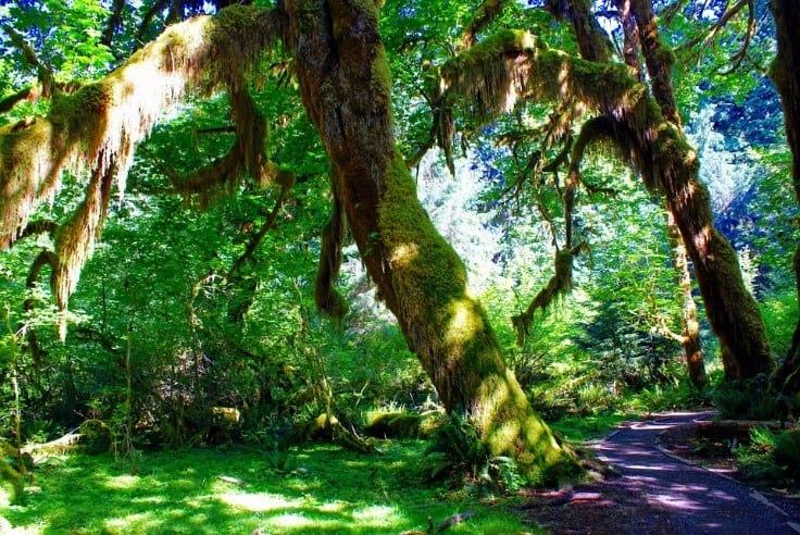
Best Hikes in Olympic National Park – Hoh Rain Forest via the Hoh River Trail
Difficulty level: Moderate to difficult
Trail type: Out and Back
Length: 17.4 miles (one-way)
Elevation gain:5682 feet
Average time to complete the hike: 13 hours – 2 days
The Hoh Rain Forest is one of the must-visit places at Olympic National Park. It is a lush, dense forest with a wide range of plants. Mosses and ferns are abundant, as well as giant western hemlocks and Sitka spruce, which grow up to 300 feet high, providing cooling shade as you hike across the rain forest.
One of the best ways to hike the Hoh Rain Forest is through the Hoh River trail. It is a 17.4-mile trail that follows the riverbank of the Hoh River. It is also suitable for overnight hiking, although you may require a permit for night hiking.
The first 13 miles section of the trail is quite flat, but it gains significant elevation in the last 4 miles as it reaches the end at Blue Glacier on the base of Mount Olympus in the Olympic Mountains of Washington. Some advanced hikers manage to go out and back, a total of 35 miles, within a day (12 hours).
However, this is unmanageable for most hikers. Besides, the last 4 miles of the trail can be quite challenging and take a significant time. In fact, that section alone can make a full-day moderate pace hike.
The best way to explore the entire rain forest is to make it a multi-day camping or backpacking tour. There are several campgrounds within and outside the rain forest, including the Elk bow campground and the Hoh rainforest campground.
The trail is heavily trafficked, especially during the peak season between April and October. Being an out and back type of hiking trail, you can go as far as you want and then go back. If you want to make the hike longer, proceed to the Hall of Mosses and Sitka Nature Trail adjacent to the Hoh River.
In late summer and early winter, some sections of the trail are filled with snow. As such, you would need an ice ax and microspikes to maneuverer. Other areas of the rain forest may be fully covered with snow making the trails untraceable.
You will require a map and compass to make your way around the rain forest. Hiking the forest is discouraged in the winter season, especially in steep sections.
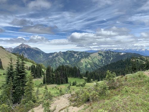
Olympic National Park Hikes the Hurricane Hill Via Hurricane Ridge Trail
Difficulty level: Easy to Moderate
Trail type: Out and Back
Length: 1.7 miles (one-way)
Elevation gain: 650 feet
Average time to complete the hike: 1.5 – 3 hours
The Hurricane Ridge Trail starts at the Hurricane Hill Visitor’s Centre up to the Hurricane Hill Mountain top. It is an easy and family-friendly 1.7 miles trail. It passes through the open forests giving you a great view all along the hike. It has moderate switchbacks just before you get to the top of the mountain.
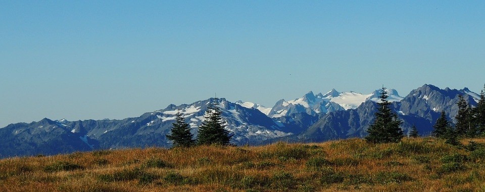
On a clear day, the top of the mountain offers a panoramic view of Olympic Park and the surrounding area. The trail is highly trafficked during peak seasons.
It is kid-friendly Olympic National Park Hikes. There are benches at different points along the trail where you can take breaks. Although the inclines are steep, children can manage them with a bit of hand-holding. Or you could get to where the switchbacks begin and then go back.
Seven Lakes Basin Loop
Difficulty level: Difficult
Trail type: Loop
Length: 19 miles
Elevation gain: 4000 feet
Average time to complete the hike: 9-12 hours
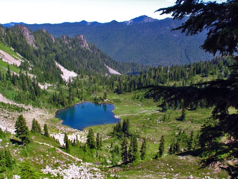
You really should make a point of exploring Seven Lakes Basin when visiting the Olympic National Park. It is located near Joyce, Washington, and offers spectacular views. It is a series of 8 small and gorgeous lakes. These are Sol Duc, Long, Lunch, Morgenroth, No Name, Clear, and Number 8. The best way to see all the lakes is to take the Seven Lakes Basin Loop.
Seven Lakes Basin Loop is 19-miles long with an elevation gain of 4000 feet. The loop starts at the Sol Duc Trailhead. A mile into the trail, you find the junction to the Seven Basins Loop. It takes you to the Sol Duc Falls, Dear Lake, and then the Lunch Lake.
It then proceeds along the Sol Duc River to the Sol Duck Park and Heart Lake. Midway through the loop is the highest point of the basin, known as the High Divide. It gives you a great view of Mount Olympus, The Hoh River Valley, Sol Duc Valley, the Seven Lake Basins, Bailey Range, and Bogachiel Peak.
Advanced hikers can complete the hike in 9-12 hours at a moderate pace, including stops to take in the breathtaking scenery. For single-day trips, it is best to start the hike by 7 am so that you have ample time to go around and come back before nightfall. Whenever possible, do the hike earlier on in the summer when the days are longer.
However, most people find a single-day trip quite overwhelming, and they break it down to a 2-3 day backpacking trip. There are several camping sites within the Seven Lake Basin and surrounding areas that are easily accessible. You can hike clockwise or counterclockwise. When you do it counterclockwise, there are more declines.
The trail consists of various terrain types, including stairs, switchbacks, rocks, roots, and trails through the woods. Some switchbacks and stairs are quite steep, while others are moderate. You may encounter wildlife such as bear, fawn, deer, and elk. There are also lots of edible berries and beautiful wildflowers along the way.
The Sevens Lake Basin Loop is open between April and October. However, the best time to hike it via the High Divide trail is July to September.
Since the trail is at a high elevation, there may be significant snow in May, June, and the beginning of July. In early July, the trail may be wet and muddy from the melted snow. While late September and October are great to enjoy the fall colors, the weather can be unpredictable.
Hole in the Wall on Rialto Beach
Difficulty level: Easy
Trail type: Out and back
Length: 3.4 miles
Elevation gain: 108 feet
Average time to complete the hike: 2 hours
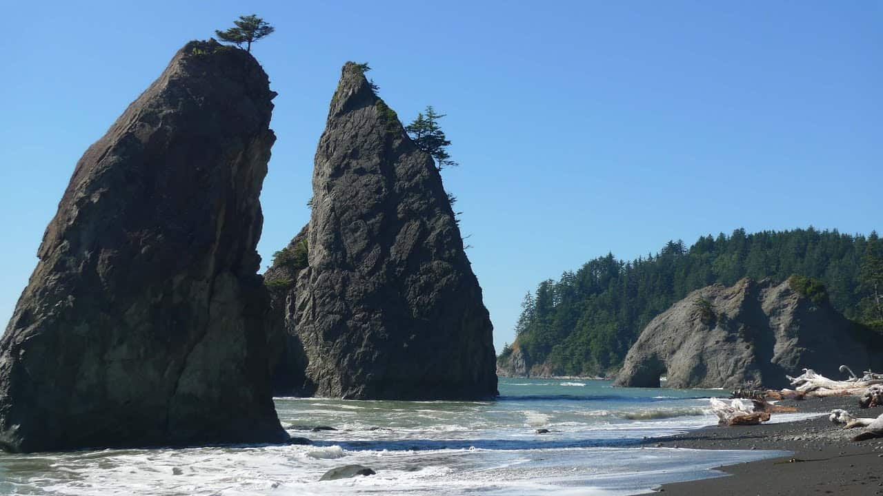
The Hole in the Wall hike is an easy 3.4-mile round trip from the Rialto beach. It is accessible all year round for hikers, campers, backpackers, and surfers as the Washington coast hardly gets snow.
Note that the Hole in the Wall is only accessible when the tide is low. Check the tide charts when planning your hike to the Hole in Wall to determine accurately when the tide is low.
The hike mainly involves walking on flat, sandy beaches. You will see rocks, sea stacks, driftwood, tide pools, and wildlife such as bald eagles.
The Hole in the Wall offers an outstanding view and highlights Rialto Beach. It is a water-carved sea rock. If you are a photographer, this one is a must capture. For easy framing, go through the hole to cross over to the other side. At about a 100 yards distance, the entire height and width of the rock should fit in your frame.
On this side of the hole, you will also be able to see the tide pools. You can dip your feet into the tide pool as long as you have water-safe shoes. Tread carefully and ensure your footing is firm as the surface beneath can be extremely slippery.
Be mindful of wildlife in the tide pools. Do not take anything out of the water. Also, avoid stepping on the animals or forcing them out of their spot.
You can also climb up to the top of the hole for a panoramic view of Rialto beach. The hike up the Hole in the Wall is quite steep, and you will require shoes with excellent traction. You also need to muster upper body strength to pull yourself up the rocks.
Enchanted Valley Via East Fork Quinault River
Difficulty level: Moderate
Trail type: Out and back
Length: 26 miles (round trip)
Elevation gain: 3700 feet
Average time to complete the hike: 2 -3 days
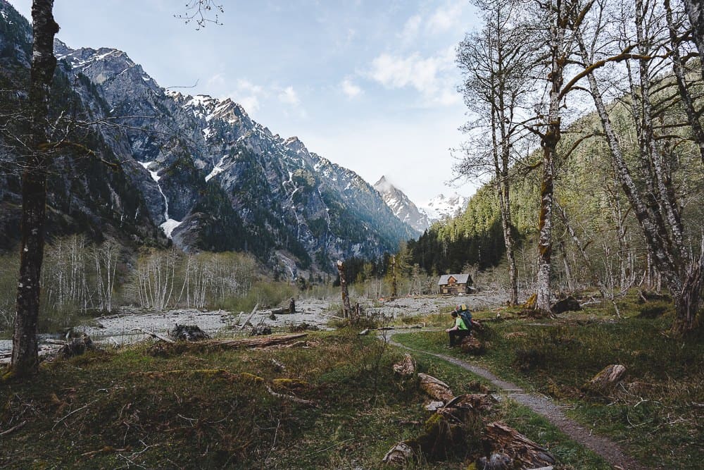
Enchanted Valley is a temperate rainforest ecosystem. It has several outstanding features, including avalanche streams, a chalet, mountain scenery, and multiple waterfalls towering from snowcapped Olympic Peaks that feed into the rainforest.
The best way to hike Enchanted Valley is through the East Fork Quinault River Trail. It is one of the most popular trails on the southeast side of the park. It is well maintained and easy to follow and offers great views throughout.
The trail has a variety of terrain, including narrow and wide paths, switchbacks, and old road grades. It passes through creeks, gorges, ridgelines, riverbanks, foot log bridges, and rocks. The temperatures are colder in the higher elevation areas.
The trail starts at the Graves Creek Trailhead. It then proceeds for 2.5 miles into the Pony bridge, leaves behind the Pony bridge, and heads to O’Neil Creek. 3-miles from the O’Neil Creek is the Pyrites Creek, and 3.2 miles further is the Enchanted Valley.
The best way to complete this hike is in a 2-3-day trip. Although it is mostly flat, some sections are quite steep and take a bit of time to get past. Although you could get through it in a day’s-hike at a fast pace, you want to allow ample time to take in all the features you will encounter.
There are several campsites within the trail, including Pony Bridge, O’Neil Creek, and the Enchanted Valley. You will need bear canisters to store your food, beverages, and scented items during the hike. Ensure to pack enough essentials to last you through the hike.
If hiking for 3 days or more, you can fit the Anderson Pass and Lake into your itinerary. They are 5.2 miles from the Enchanted Valley. The trail is steep, rocky, and narrow, making it a challenging hike. There is a river crossing at the O’Neil Pass Junction that can become hazardous if it is rainy or there is significant snowmelt.
There are many animals across the rainforest, including black bears, deer, elks, mountain lions, coyotes, bobcats, river otters, and beavers. You may come across these animals, notice animal tracks along the trail, or hear them make sounds
The best time to visit Olympic National Park for this hike is in summer between July and August, when the weather is warm and predictable. The trail is also accessible in early summer and fall. However, since this is a low elevation area, the weather in fall and spring can be cooler, wetter, and sometimes unpredictable. Even when hiking during the summer, check weather forecasts as there can be sudden whiteouts and storms.
Best Hikes in Olympic National Park
The above hikes take you to some of the highlights in Olympic. The park has three different ecosystems which offer a lot to explore:
- Lush temperate forests
- Rugged Pacific coastline
- Glaciated mountains
One of the best ways to explore the park comprehensively is to plan a multiple-day hiking trip. You can choose to break down the itinerary to include the various ecosystems on different days or explore one region elaborately. Even so, one multi-day hiking trip to the park is not enough to see everything, and you should definitely plan to visit the park again.
Best Time to Visit Grand Teton National Park
Zion National Park Camping | Camping in Zion
Glacier National Park Camping
Best Time to Visit the Grand Canyon National Park
Best Time to Visit Joshua Tree National Park
Best Time to Visit Death Valley
Best Time to Visit Acadia National Park
Yosemite Hiking Trails
Yellowstone Hiking Trails
Things to Do in Rocky Mountain National Park
Best Time to Visit Zion National Park
Best Time to Visit Glacier National Park
Best Time to Visit Yellowstone
Best Time to Visit Yosemite
National Parks in the USA That Should Be On Your Travel List
Best Time to Visit Crater Lake
Crater Lake Camping
The Best Crater Lake Hikes
