Last Updated on May 7, 2023 by Aswetravel
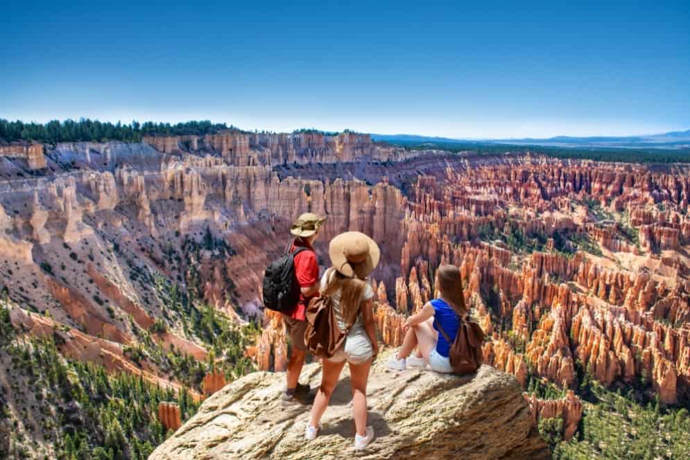
Best Hikes in Bryce Canyon – Bryce Canyon National Park has dramatic scenery that entices hikers. Gold and glowing orange hoodoos welcome you as you gaze out over the main theater from a sunset or sunrise point. You can see the twisting tracks that extend throughout the canyon from these points.
There’s a scattering of giant pines mixed into the scene. The stone formation sizes next to them overshadow the pines.
Bryce Canyon hikes can differ from heart-pounding, half-day tracks, or easy paved trails.
This article contains a list of strenuous, moderate, and easy hikes in Bryce Canyon National Park, all of which are worth the effort and outstanding views.
Where Can I Find the Best Hikes in Bryce Canyon
1. Navajo Loop Trail
This is among the most popular tracks, and it typically takes one to two hours. It starts from the rim at sunset point to the floor of Bryce Canyon. You will have time to visit famous hoodoo formations, including Thor’s hammer, Twin Bridges and Wall Street.
The track slopes immediately from Sunset Point into a paved pathway with safety railings on its edges. The barriers end after about 100 feet. The path splits here, leading to the right (south) and another trail leading to the left (east).
The path on the left is the eastern leg of the Navajo Loop, while the paths on the right lead to an upper and lower track. The trail on the upper side has a window nearby, looking through a hoodoo wall to the west of Bryce Canyon.
The lower track is the initial segment of the Navajo Loop; it begins a fast descent along a sequence of short and long bends down to the canyon floor.
At the foot, the track straightens out and gradually slopes through Wall Street, where, in the rift’s depths, there are two towering Douglas firs. The conifers have been growing on the rift for over 750 years.
Large hoodoo formations on the pathway provide excellent views for hikers. You will encounter the Twin Bridges located on the right trackside about a mile into the hike.
Further down the Twin Bridges, the pathway ascends into a sequence of bends to go back to the rim. Thor’s hammer is located to the north in this last track section.
Queens Garden and Navajo Loop together give visitors the most exhilarating 3-mile hike opportunity.
2. Sunset to Sunrise Points
The Queen’s Garden trail is a simple 1.8-mile track. However, the path can feel like a loop trail, as the views in every direction are different.
This is the perfect trail to hike on if you are short on time. The course offers just as much beauty and diversity as the Navajo trail, but the best part is that it’s only half the distance.
From Sunrise Point, the hike descends into the limestone ridges and the tops of mud which veer into the canyon. The cliffs on this trail are dotted with pine trees, and colorful hoodoos rise and surround you.
In most trail sections, the track is of moderate width. However, there are drop-offs on one or both ridge sides. The drop-offs are not sheer cliff walls. They are just sharp slopes of mud and crumbling rock.
You will pass through some artificial arches in some places. There is a lot of incredible scenery to take in on this trail, and it offers great photo ops.
The Queen’s Garden is on the course’s farthest end, where there’s a thick patch of pine trees that provide brilliant shade for benches.
You can view a hoodoo from the garden that looks like Queen Victoria seated on her throne. To return to the parking area, use the same route.
Hiking under the rim is the best way to see the hoodoos in Bryce Canyon. These tracks lead you down to the canyon, allowing you to walk amid the gigantic hoodoos.
4. Bryce Canyon National Park Fairyland Loop
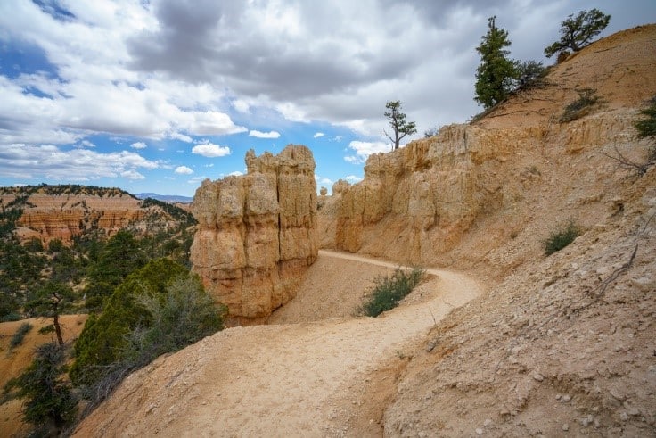
If you fancy a longer hike, look into Fairyland Loop. The pathway leads you to a great route through hoodoos and alongside ridges that offer incredible views and an up-close look at the strange formations.
The trail can feel like a canopy walk through a forest of hoodoos in some sections, aiding your view of balanced rocks on top of spires. The pink, cream, orange, and gold hues are striking in this track.
You can add a hike to Tower Bridge if you wish—this can be a separate hike.
The Fairyland Loop Trail is an 8-mile hike with an elevation gain of about 2,300 feet. The distance and elevation make the hike strenuous, although technically, it’s not.
You can begin your hike from the campground if you have set up a camping site at Bryce’s North Campground. Otherwise, you can start your walk from Sunrise Point or Fairyland Point. If you start at Sunrise Point, you will cover a longer distance.
5. Mossy Cave Trail
Mossy Cave Trail leads to a cave, ideally more of a moist overhanging shelf. The true beauty of this trail lies in the river and waterfall that cut through the scenery at the hill’s foot covered with hoodoos.
The track is mainly along the river, crossing a bridge at some point. The trail then ascends to Mossy Cave, after which it splits along the ascent. Its left course leads to the cave, while on the right is an area where you can view the river and the falls.
Mossy Cave hiking trail is among the few treks that begin outside the park’s entrance station. The trail is approximately four miles outside the park, and the trailhead is on Highway 12.
The course is not strenuous and offers a distinctively different view. Follow a streamlet to Mossy Cave. The moss hanging in the cave drips water in the summer, changing to icicles in the winter.
The Mossy Cave hiking trail provides a stunning scenery change from the Bryce Canyon Amphitheater hoodoos, which are dry and orange. Being among the most accessible Bryce hiking trails, the Mossy Cave Trail is an excellent alternative for those short on time or those traveling with their family.
This trail has gained fame over the years. It may be hard to secure a spot here from 10 AM to 6 PM because of limited parking space. You can’t park outside the parking lot or along the road.
6. Hat Shop
Hat Shop is named after the white rocks resting perilously along the hoodoos’ top hike. This trail is excellent for those who have hiked on several other courses and are searching for a less crowded path. It’s also ideal for those who want a physical challenge.
This trail is a knee-buster that should only be attempted by those in good shape. The length of this trail is four miles, in and out. The track descends steadily into the canyon beyond the hoodoo formations. When at the base, turn around and look 1,000 feet up to view the return trip ahead of you.
The views are distinct in every direction. Stop, rest and look at the Kaiparowits Plateau and the vista over the Paria River Valley.
The Hat Shop stretches over the known backcountry Under-the-Rim Track. You could begin at Bryce Point, a similar trailhead to Peekaboo Loop. Hat Shop is uncrowded and quiet, unlike the more well-known Peekaboo Trail.
Although this trail is just four miles long, it’s steep, rough on the knees, and strenuous. This hike isn’t recommended for those on their first visit to Bryce Canyon.
7. Peek-a-Boo Loop Trail
Peekaboo Loop is the ideal spot for hikers and is one of the most liked trails in Bryce Canyon National Park. It is longer than the hikes amidst the hoodoos and is a perfect way to traverse Bryce Canyon minus the Navajo Trail crowds.
The steep trail begins from Bryce Point, with a well-known view and scenic excursion. From this point, you’ll hike in a clockwise manner, descending fast into the canyon floor. The trail spreads over stunning viewpoints such as the Wall of Windows.
You will hike some miles winding through the amphitheater before climbing 1,500 feet back to Bryce Point.
The trail, which is 5.5 miles long, is a better option than the Navajo Trails and Queen’s Garden, which are busier. You will descend steeply into the Bryce Canyon Amphitheater depths via massive hoodoos.
The Wall Windows is a unique feature to see along the Peek-a-Boo Loop. Wall Windows cracks and arches in the upper parts linking hoodoo frame and the blue sky behind.
This Bryce Canyon hike has over 1,500 feet altitude gain, most of it taking place over an extremely short distance, making for a stiff hike.
8. Bristlecone Pines Hike
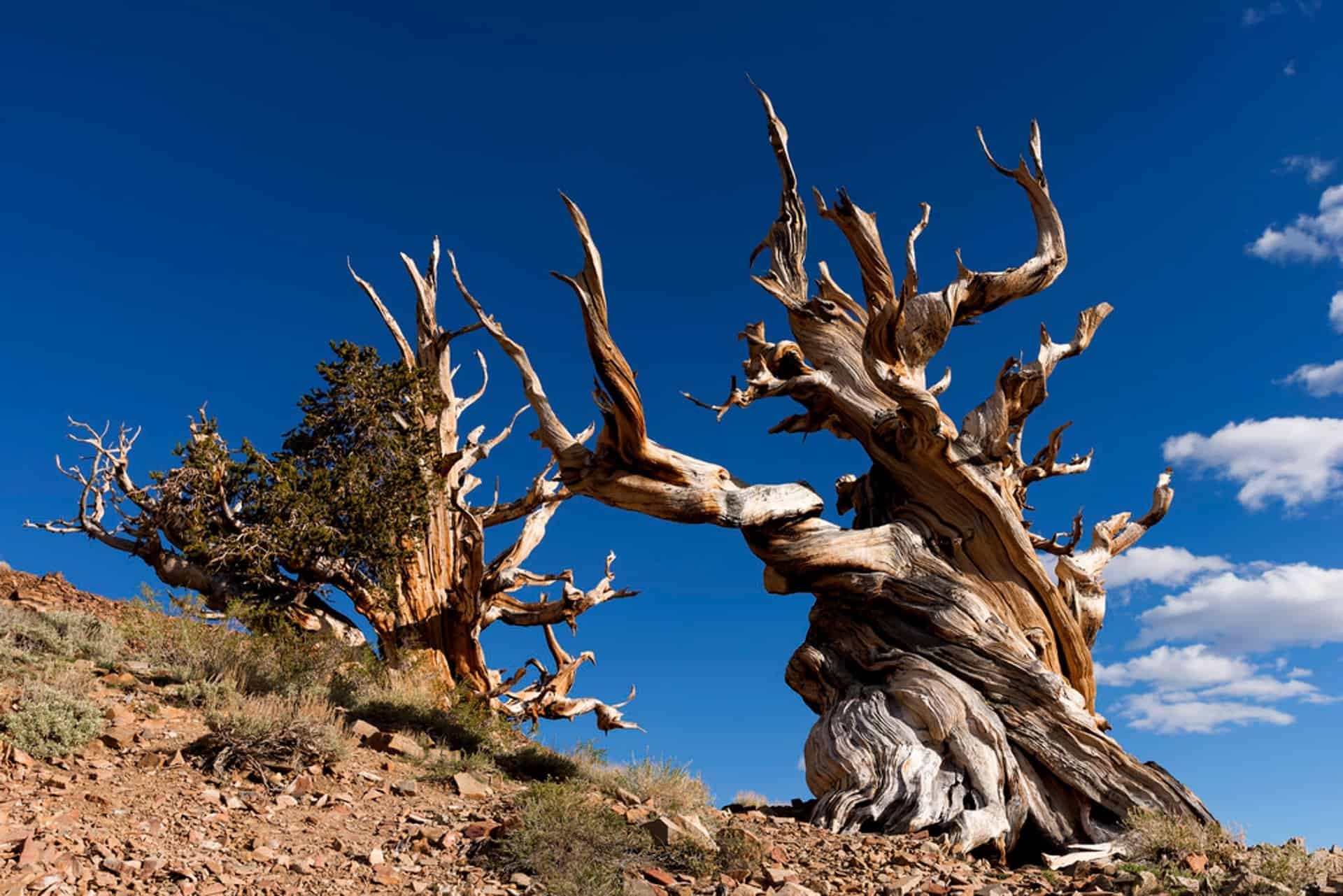
Rainbow Point, the highest point, marks the start of the Bristlecone Loop Trail. You’re hiking 9,000 feet above sea level along this trail. This is the ideal stretch to take a break from the spectacular drive up to Rainbow Point and return down.
The oldest living species globally are Bristlecone Pines, the trail’s namesake. A 1,600-year-old tree is the oldest of all. The trail weaves through a forest of Douglas fir, blue spruce, and white fir and has fantastic scenery over the canyon. You can look out for wildlife and birds.
Rainbow is the starting point for the Bristlecone Pines hike—at the highest park region, which is at the park’s south end.
There are cooler temperatures up here than other park areas, and there may be snow lingering around. Therefore, hikes may be impossible during the winter through to the spring.
9. Tower Bridge
Try out the out-and-back Tower Bridge hike if you’re not up for the Fairyland Loop Trail. This trail stretches over part of the Fairyland Trail before deviating to a conspicuous stone structure called Tower Bridge.
You can also view Bristlecone Pines during the three-mile trek as it winds through hoodoos and past the vibrant Chinese stone wall.
This hike is a moderate out-and-back with 800 feet altitude gain and a few shaded areas next to Tower Bridge.
Tips for a Better Bryce Canyon Hike
Use these tips for the best time hiking in Bryce Canyon!
- Begin the hike early—there isn’t enough parking space in Bryce Canyon, and the parking areas fill up before noon during early fall and late spring. You should arrive immediately after sunrise to secure a parking lot. Early morning is also the best lighting you will find in the Bryce Amphitheater.
- Capture sunrise before your hike. Watching sunrise along Rim Trail either at Sunrise or Sunset Point should be among the things on your bucket list experience in Bryce Canyon. This is the best way to begin your day at Bryce Canyon National Park.
- The day gathers warmth as the sun rises. Put on several layers of clothes—the temperatures are usually below freezing overnight at times, including throughout the fall and spring seasons. You should dress in many layers, like a down jacket, a fleece jacket, and long sleeve top.
- Get ready for thunderstorms during the summer hikes. During the summer, thunderstorms often occur in Utah, which can be hazardous for hikers. Analyze the weather forecast before going out for a hike.
- Carry plenty of water—when going for hikes, it’s essential to carry plenty of water, even on colder days. The Utah Mighty’s five national parks have the highest altitude in the Bryce Canyon. You will dehydrate more quickly than usual at this elevation. Pack at least half a liter of water per head per hiking hour.
It’s Time to Go Hiking in Bryce Canyon National Park
Thousands of guests visit Bryce Canyon National Park yearly, sometimes missing out on some gems outside the park’s borders.
Whether you’re a first-time visitor to the park or are a local, several new adventures are waiting to brighten your excursion through Bryce Canyon National Park.
Glacier National Park Camping
Best Time to Visit Glacier National Park
Best Time to Visit the Grand Canyon National Park
Things to Do in Rocky Mountain National Park
Yellowstone Hiking Trails
Best Time to Visit Yellowstone
Yosemite Hiking Trails
Best Time to Visit Yosemite
Best Time to Visit Grand Teton National Park
Best Death Valley Hikes and Tips for Hiking Death Valley
Things to Do at Mammoth Cave
Best Time to Visit Sequoia National Park
Grand Teton Hikes
Best Hikes in Bryce Canyon
Best Time to Visit Death Valley
Best Time to Visit Acadia National Park
Best Hikes in Arches National Park
