Best Hikes in Pinnacles National Park – One of the benefits of being the smallest national park in California is that you can see the most important features of the park by hiking just a few of the trails. Pinnacles National Park is home to many unique hiking trails. There is a trail for everyone in Pinnacles National Park and we’re going to shine the spotlight on the best hikes in Pinnacles National Park today in our complete guide.
Pinnacles Hiking
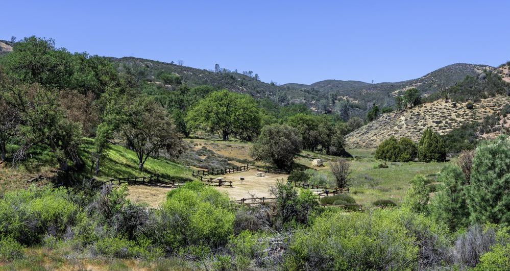
There are a little more than 30 total miles of trails in Pinnacles National Park, and if you do it the right way, you can see all of the major landmarks in Pinnacles National Park while hiking the trails.
When to Visit for the Best Hikes in Pinnacles National Park
Pinnacles National Park is located in central California so it has mild winters and very hot summers. For hiking, it is best to hike in Pinnacles National Park between October and May. The summer months in Pinnacles National Park can become brutal, reaching temperatures in the upper 90s and even over 100 degrees Fahrenheit on some days.
Because of this, you should try to avoid hiking in Pinnacles National Park during June, July, and August. If you do plan to hike Pinnacles National Park during the summer, make sure you wear plenty of sunscreen and drink plenty of water.
During the fall months of October, November, and early December, temperatures can reach the 70s. It may start out chilly in the mornings but by the afternoons, it will be extremely comfortable with temperatures that often stay near 70 degrees Fahrenheit.
The coldest months in Pinnacles National Park are January and February but it’s still mild and comfortable – especially for hiking. The daily high temperature during January and February averages in the 60s, making hiking comfortable in Pinnacles National Park even during the winter months.
Starting in March, it starts to warm up in Pinnacles National Park. Between March and May, temperatures can reach the 70s during the day. In May, temperatures may be closer to 80 degrees Fahrenheit, so if you’re trying to avoid the heat, you’ll want to visit the park during the late fall, winter, or early spring months.
Always make sure that you check the weather forecast before any hike. It’s important to be prepared with the right supplies including sunscreen and water.
Best Pinnacles National Park Hiking Trails
Pinnacles National Park is named after the Pinnacles – a mountainous landform that was formed by an extinct volcano that was displaced more than 200 miles from the San Andreas Fault. But it’s not just the Pinnacles that are the star of the show at Pinnacles National Park.
There are caves and overlooks that allow you to explore both natural formations as well as the many species of wildlife that inhabit the park, so let’s get started!
Trails at the Pinnacles Visitor Center
There are three trails that you can access from the Pinnacles Visitor Center.
- Bear Gulch Day Use Area – The Bear Gulch Day Use Area trail is a one-way, 2.3-mile moderate trail with an elevation of 300 feet. It connects the Pinnacles Visitor Center to the Bear Gulch Day Use Area where you can create a home base for you and your family during the day.
- South Wilderness Trail – The South Wilderness Trail is a 6.5-mile round-trip moderate trail that is a visitor favorite for those who enjoy viewing wildlife.
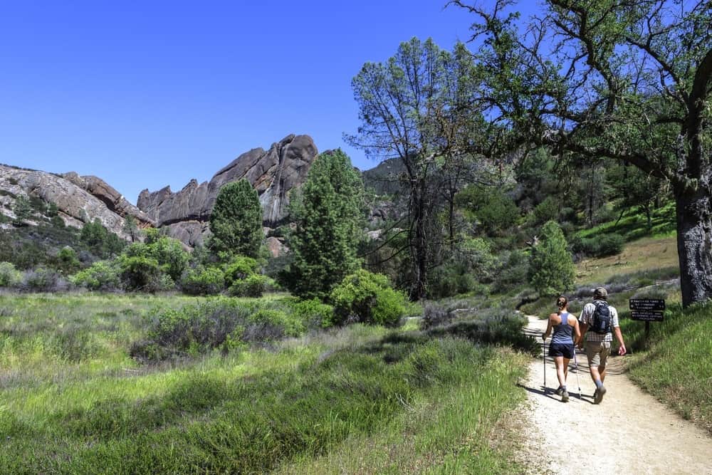
- Balconies Cave Trail – The Balconies Cave Trail from the Pinnacles Visitor Center is a 9.4 round-trip moderate trail that has a total elevation of 300 feet. From the Pinnacles Visitor Center to the Balconies Trail, you will hike the Chalone Creek along the Bench Trail and Old Pinnacles Trail to arrive at Balconies Cave. You will need a flashlight to enter Balconies Cave. When leaving Balconies Cave, you will cross the cave using the Balconies Cliff Trail which will give you great views of some of the park’s largest rock formations.
Trails from Bear Gulch Day Use Area
There are five total trails you can take from the Bear Gulch Day Use Area.
- Moses Spring to Rim Trail Loop – The Moses Spring to Rim Trail Loop can be accessed from the Bear Gulch Day Use Area. It is a moderate 2.2-mile round-trip trail that has a total elevation of 500 feet. This is an ideal trail to take if you want to view the many rock formations that are found in Pinnacles National Park. You can also access the talus caves and the reservoir from this hike. It’s one of the best hikes in Pinnacles National Park.
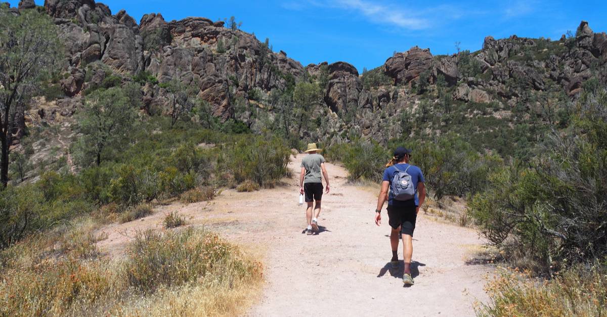
- Condor Gulch to High Peaks Loop – This is a tough trail to hike and is only recommended for those who have the experience of hiking strenuous, steep, and narrow trails. It is a 5.3-mile round-trip hiking trail that has a total elevation of 1,300 feet. The trail gets steep and narrow during some parts, making it a strenuous trail.
- High Peaks Trail to Bear Gulch Loop – Another strenuous hiking trail is the High Peaks Trail to Bear Gulch Loop trail. It is a 6.7-mile round-trip trail with an elevation of 1,425 feet. If you want to view the many wildflowers that bloom in Pinnacles National Park, the High Peaks to Bear Gulch Loop trail is one of the best.
- Condor Gulch Trail – The Condor Gulch Trail is a moderate 1.7-mile one-way trail that gives you beautiful views of the High Peaks. The trail begins as moderate and then increases to strenuous. You don’t have to hike the entire trail to view the High Peaks either. There are many views of the High Peaks along the trail for you to enjoy.
- Chalone Peak Trail – The Chalone Peak Trail is a strenuous 9-mile round-trip trail with an elevation of 2,040 feet. On this trail, you can hike to North Chalone Peak which is the highest monument in Pinnacles National Park. You can also hike to South Chalone Peak from this trail using an unmaintained trail.
Old Pinnacles Trailhead
There is only one hiking trail you can hike from the Old Pinnacles Trailhead. This is the Old Pinnacles Trail to Balconies Cave which is a moderate 5.3-mile round-trip trail that takes you to Balconies Cave by way of the Old Pinnacles Trailhead. Part of the hike is sunny while the other part is within the cave, so make sure you bring both sunscreen and a flashlight on this hike.
Trails from West Pinnacles Contact Station
There are two trails from the West Pinnacles Contact Station.
- Prewett Point Trail – The Prewett Point Trail is an easy trail for anyone to enjoy. It is a short, 0.9-mile round-trip trail that is wide and easy for all types of hikers. This is a great hike for beautiful views of the Hain Wilderness.
- Jawbone Trail – The Jawbone Trail is an easy-to-moderate trail that is 1.2 miles and actually descends as the trail continues. It has an elevation of -560 feet. It is a narrow dirt trail that leads to a beautiful overlook at the loop.
Trails from the West Pinnacles
There are four different trails you can access from the West Pinnacles.
- Balconies Cliff Cave Loop Trail – The Balconies Cliff Cave Loop Trail is a 2.4-mile round-trip trail that is easy to moderate for most hikers to enjoy. The trail leads to the Balconies Cliff Cave and then descends back to the Old Pinnacles Trail.
- Juniper Canyon Loop – The Juniper Canyon Loop is a strenuous 4.3-mile round-trip trail with a total elevation of 1,215 feet. It is a steep trail that circles through the High Peaks and descends back to the Tunnel Trail.
- North Wilderness Loop Trail – The North Wilderness Loop Trail is an unmaintained strenuous trail that is 9.3 miles round-trip. The trail follows the peaks and descends into the Chalone Creek Bed. You will then take the Old Pinnacles Trail and Balconies Cave Trail to return.
- High Peaks to Balconies Cave Loop – The High Peaks to Balconies Cave Loop Trail is a strenuous 8.4-mile round-trip trail that ascends 1,540 feet. You will climb the High Peaks and then finish the trail using the Old Pinnacles and Balconies trails. You can choose to go over the cave or through the cave on your return trip.
Hiking in Pinnacles National Park
Pinnacles National Park has a hiking trail for everyone. Whether you want to see the rock formations of the Pinnacles or simply the flora and fauna that inhabit the area, you can view anything you choose by hiking one of the many trails in Pinnacles National Park.
FAQs
Can You Drive in Pinnacles National Park?
There are no roads you can drive through Pinnacles National Park. You will need to park in one of the parking areas and hike to the various landmarks that you want to see.
Where Is the Entrance to Pinnacles National Park?
There are two entrances to Pinnacles National Park. There is an east entrance and a west entrance. The east entrance is near Hollister and will give you access to the Moses Spring Parking Area. The west entrance is near Soledad and is considered the better of the two entrances for entering Pinnacles National Park because of the visitors’ center and access to the many trailheads.
Best Time to Visit Pinnacles National Park
Best Hikes in Pinnacles National Park
Pinnacles National Park Camping
Best Time to Visit Death Valley
Best Time to Visit Joshua Tree National Park
Best Time to Visit Death Valley
Yosemite Hiking Trails
Best Time to Visit Yosemite
National Parks in the USA That Should Be On Your Travel List
Kings Canyon National Park Camping
Best Time to Visit Lake Tahoe
Lassen Volcanic National Park Camping
Lassen Volcanic National Park Things To Do
Redwood National Park Camping
Redwood National Park Things To Do